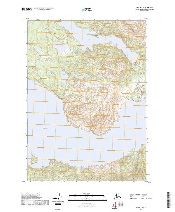
2024 Map of Kenai B-1 NW
USGS Topo · Published 2024About this map
Kenai National Wildlife Refuge dominates this northern peninsula landscape, where complex glacial terrain is defined by a dense network of freshwater lakes and connecting trails. The northern half of the sheet centers on large water bodies including Hidden Lake, Engineer Lake, and the island-dotted Skilak Lake to the south. These lakes are connected by a legacy of backcountry routes such as the Seven Lakes Trl and Bear Mountain Trl, which navigate the steep elevation changes between the shorelines.
Find a feature on this map
26 named features on this map. Tap any name to fly to it.
Don’t see what you’re looking for? This feature index may not catch every label — zoom into the map to look around manually.
Map Details
Editions of this 2024 Kenai B-1 NW Map
This is the sole edition of this map. No revisions or reprints were ever made.
Other maps of this area

1944 · Kenai
USGS Topo · 1:250,000

1950 · Kenai
USGS Topo · 1:250,000

1950 · Kenai B-1
USGS Topo · 1:63,360

1951 · Kenai B-2
USGS Topo · 1:63,360

1951 · Kenai C-1
USGS Topo · 1:63,360

1951 · Kenai C-2
USGS Topo · 1:63,360

1952 · Kenai C-1
USGS Topo · 1:63,360

1952 · Kenai C-2
USGS Topo · 1:63,360

1952 · Kenai B-2
USGS Topo · 1:63,360

1952 · Kenai B-1
USGS Topo · 1:63,360