
1952 Map of Kenai C-1
USGS Topo · Published 1954About this map
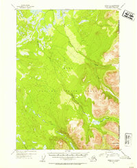
The Kenai National Moose Range dominates this mid-century topographic survey, where the rugged topography of the Kenai Peninsula transitions from low-lying wetlands into the steep slopes of the Chugach National Forest. The drainage systems of the Chickaloon River and Mystery Creek are central to this landscape, illustrating the intricate network of glacial runoff and mountain streams that define the region. Evidence of early backcountry access is found in the Seven Lakes Trail and the Ski Mobile Trail, providing a look at how this wilderness was navigated before modern infrastructure reached deep into the interior. A solitary Cabin in the northern reaches and landmarks like Round Mountain serve as rare points of human reference in a terrain characterized by complex contouring and numerous small water bodies like Jean Lake and Hidden L.
Find a feature on this map
12 named features on this map. Tap any name to fly to it.
Don’t see what you’re looking for? This feature index may not catch every label — zoom into the map to look around manually.
Map Details
Editions of this 1952 Kenai C-1 Map
2 editions found
Other maps of this area

1944 · Kenai
USGS Topo · 1:250,000

1950 · Kenai
USGS Topo · 1:250,000

1950 · Kenai B-1
USGS Topo · 1:63,360

1951 · Seward
USGS Topo · 1:250,000

1951 · Kenai B-2
USGS Topo · 1:63,360

1951 · Kenai C-1
USGS Topo · 1:63,360

1951 · Kenai C-2
USGS Topo · 1:63,360

1951 · Kenai D-1
USGS Topo · 1:63,360

1951 · Kenai D-2
USGS Topo · 1:63,360

1951 · Seward C-8
USGS Topo · 1:63,360