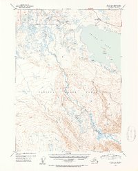
1952 Map of Kenai B-2
USGS Topo · Published 1954About this map
The Kenai National Moose Range dominates this mid-century portrait of the Kenai Peninsula, where the glacially-fed waters of Skilak Lake transition into the Kenai River. The landscape is a network of waterways and isolated settlements, with numerous Cabins and a Skilak Guard Station marking human presence in this immense wilderness. The recently established Sterling Highway cuts across the northern terrain, providing a vital connection through the interior near Torpedo Lake.
Find a feature on this map
14 named features on this map. Tap any name to fly to it.
Don’t see what you’re looking for? This feature index may not catch every label — zoom into the map to look around manually.
Map Details
Editions of this 1952 Kenai B-2 Map
2 editions found

Other maps of this area

1944 · Kenai
USGS Topo · 1:250,000

1950 · Kenai
USGS Topo · 1:250,000

1950 · Kenai C-3
USGS Topo · 1:63,360

1950 · Kenai B-1
USGS Topo · 1:63,360

1950 · Kenai B-3
USGS Topo · 1:63,360

1951 · Kenai B-2
USGS Topo · 1:63,360

1951 · Kenai C-1
USGS Topo · 1:63,360

1951 · Kenai C-2
USGS Topo · 1:63,360

1951 · Kenai A-3
USGS Topo · 1:63,360

1951 · Kenai A-2
USGS Topo · 1:63,360