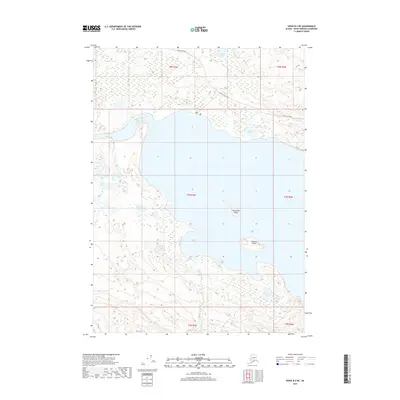
2017 Map of Kenai B-2 NE
USGS Topo · Published 2017About this map
The Kenai River corridor dominates this 2017 survey, flowing through a landscape defined by an extensive network of glacial lakes and wetlands on the Kenai Peninsula. Access to this territory is primarily focused along Skilak Lake Road in the northern sections, while much of the southern area remains an intricate maze of water bodies including Blizzard Lake, Marsh Lake, and Swan Lake. The survey detail highlights several notable islands, most prominently the aptly named Frying Pan Island and Caribou Island, which sit within the larger river expansion. Smaller tributary systems such as Olson Cr and King County Cr drain the surrounding marshlands, connecting a series of smaller named basins like Fire Lake and Kaknu Lake. This map captures the modern hydrologic character of the peninsula, showing the township and range lines that divide this largely roadless wilderness.
Find a feature on this map
20 named features on this map. Tap any name to fly to it.
Don’t see what you’re looking for? This feature index may not catch every label — zoom into the map to look around manually.
Map Details
Editions of this 2017 Kenai B-2 NE Map
This is the sole edition of this map. No revisions or reprints were ever made.
Other maps of this area

1944 · Kenai
USGS Topo · 1:250,000

1950 · Kenai
USGS Topo · 1:250,000

1950 · Kenai B-1
USGS Topo · 1:63,360

1951 · Kenai B-2
USGS Topo · 1:63,360

1951 · Kenai C-1
USGS Topo · 1:63,360

1951 · Kenai C-2
USGS Topo · 1:63,360

1952 · Kenai C-1
USGS Topo · 1:63,360

1952 · Kenai C-2
USGS Topo · 1:63,360

1952 · Kenai B-2
USGS Topo · 1:63,360

1952 · Kenai B-1
USGS Topo · 1:63,360