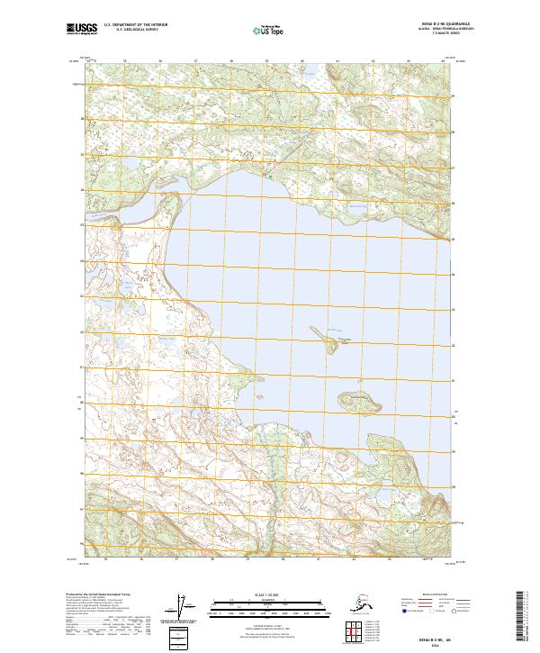
2024 Map of Kenai B-2 NE
USGS Topo · Published 2024About this map
Skilak Lake dominates this portion of the Kenai Peninsula, where the waters of the Kenai River enter from the west. The landscape is a complex network of glacial remnants and protected lands, most notably within the Kenai Wilderness (Andrew Simons Unit) and the Kenai National Wildlife Refuge. Small islands such as Caribou Island and Frying Pan Island dot the southern expanse of the lake, while a series of smaller inland water bodies like Marsh Lake, Blizzard Lake, and Fire Lake characterize the northern forest. Access to the shoreline is defined by the Skilak Lake Road and Lower Skilak Campground Road, which navigate the terrain between the wetland basins of Olson Creek and King County Creek. This mapping reflects a modern era of conservation and recreation in one of Alaska's most significant ecological corridors.
Find a feature on this map
22 named features on this map. Tap any name to fly to it.
Don’t see what you’re looking for? This feature index may not catch every label — zoom into the map to look around manually.
Map Details
Editions of this 2024 Kenai B-2 NE Map
This is the sole edition of this map. No revisions or reprints were ever made.
Other maps of this area

1944 · Kenai
USGS Topo · 1:250,000

1950 · Kenai
USGS Topo · 1:250,000

1950 · Kenai B-1
USGS Topo · 1:63,360

1951 · Kenai B-2
USGS Topo · 1:63,360

1951 · Kenai C-1
USGS Topo · 1:63,360

1951 · Kenai C-2
USGS Topo · 1:63,360

1952 · Kenai C-1
USGS Topo · 1:63,360

1952 · Kenai C-2
USGS Topo · 1:63,360

1952 · Kenai B-2
USGS Topo · 1:63,360

1952 · Kenai B-1
USGS Topo · 1:63,360