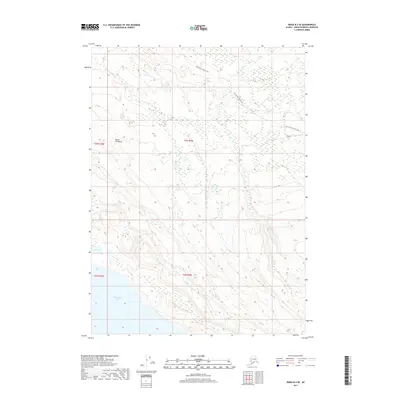
2017 Map of Kenai B-3 SE
USGS Topo · Published 2017About this map
Tustumena Lake anchors the southern landscape of this portion of the Kenai Peninsula, where the vast shoreline meets a series of inland ridges and drainages. The northern reaches are defined by a complex network of wetlands and small water bodies, including Fox Lake, providing a clear record of the area's hydrology and land elevation in the early 21st century. Access through this wilderness is marked by the winding path of the Funny River-Horse Trail, which traverses the northern townships. The map documents the specific survey boundaries of t3n r9w and t2n r9w, illustrating how public land survey systems overlay the natural topography of the Alaskan interior near the glacial waters of Tustumena.
Find a feature on this map
9 named features on this map. Tap any name to fly to it.
Don’t see what you’re looking for? This feature index may not catch every label — zoom into the map to look around manually.
Map Details
Editions of this 2017 Kenai B-3 SE Map
This is the sole edition of this map. No revisions or reprints were ever made.
Other maps of this area

1944 · Kenai
USGS Topo · 1:250,000

1950 · Kenai
USGS Topo · 1:250,000

1950 · Kenai B-3
USGS Topo · 1:63,360

1951 · Kenai B-2
USGS Topo · 1:63,360

1951 · Kenai A-3
USGS Topo · 1:63,360

1951 · Kenai A-2
USGS Topo · 1:63,360

1952 · Kenai B-3
USGS Topo · 1:63,360

1952 · Kenai B-2
USGS Topo · 1:63,360

1952 · Kenai A-2
USGS Topo · 1:63,360

1952 · Kenai A-3
USGS Topo · 1:63,360