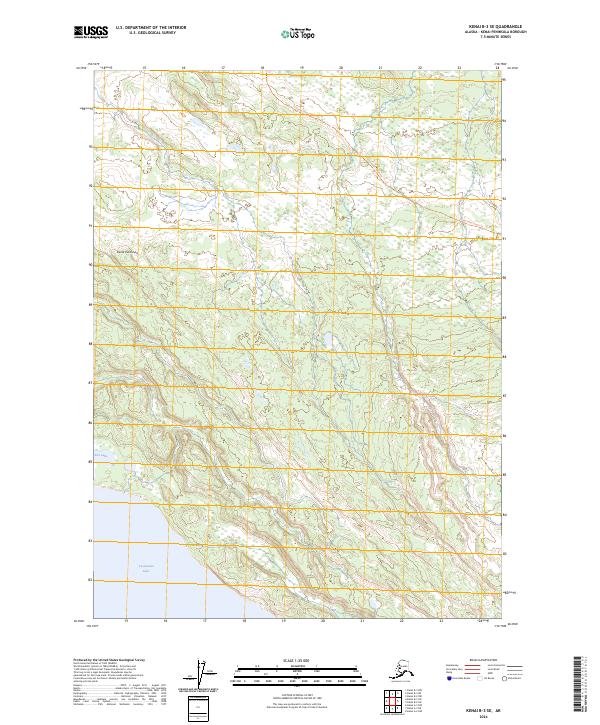
2024 Map of Kenai B-3 SE
USGS Topo · Published 2024About this map
The Kenai National Wildlife Refuge dominates this stretch of the Kenai Peninsula, showcasing a landscape largely preserved for its natural character. The presence of the Kenai Wilderness (Andrew Simons Unit) indicates a high level of environmental protection, where human impact is limited to specific paths like the Funny River Horse Trl. This trail provides a rare corridor through the undulating terrain north of the massive Tustumena Lake, which frames the southwestern corner of the quadrangle. Smaller water bodies like Fox Lake dot the western edge, illustrating the glacial and hydrological patterns typical of the region. The map reveals a wild interior where the absence of roads and settlements emphasizes the peninsula's role as a biological sanctuary, with only the survey lines of t3n r9w and t2n r9w overlaying the wilderness.
Find a feature on this map
10 named features on this map. Tap any name to fly to it.
Don’t see what you’re looking for? This feature index may not catch every label — zoom into the map to look around manually.
Map Details
Editions of this 2024 Kenai B-3 SE Map
This is the sole edition of this map. No revisions or reprints were ever made.
Other maps of this area

1944 · Kenai
USGS Topo · 1:250,000

1950 · Kenai
USGS Topo · 1:250,000

1950 · Kenai B-3
USGS Topo · 1:63,360

1951 · Kenai B-2
USGS Topo · 1:63,360

1951 · Kenai A-3
USGS Topo · 1:63,360

1951 · Kenai A-2
USGS Topo · 1:63,360

1952 · Kenai B-3
USGS Topo · 1:63,360

1952 · Kenai B-2
USGS Topo · 1:63,360

1952 · Kenai A-2
USGS Topo · 1:63,360

1952 · Kenai A-3
USGS Topo · 1:63,360