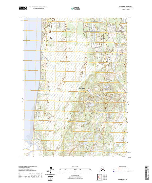
2024 Map of Kenai B-4 NE
USGS Topo · Published 2024About this map
Kalifonsky Beach and the coastal bluffs overlooking Cook Inlet anchor this contemporary look at the Kenai Peninsula’s western shore. The landscape transitions from the tidal waters to the upland marshes and spruce forests that characterize the Kenai National Wildlife Refuge on the eastern boundary. The layout of the region reflects its aviation and educational significance, with both Kalifonsky Meadows Airport and Gaede Airport serving as local hubs near Alaska Christian College.
Find a feature on this map
98 named features on this map. Tap any name to fly to it.
Don’t see what you’re looking for? This feature index may not catch every label — zoom into the map to look around manually.
Map Details
Editions of this 2024 Kenai B-4 NE Map
This is the sole edition of this map. No revisions or reprints were ever made.
Other maps of this area

1944 · Kenai
USGS Topo · 1:250,000

1950 · Kenai
USGS Topo · 1:250,000

1950 · Kenai C-3
USGS Topo · 1:63,360

1950 · Kenai B-3
USGS Topo · 1:63,360

1951 · Kenai C-4
USGS Topo · 1:63,360

1951 · Kenai C-3
USGS Topo · 1:63,360

1951 · Kenai B-4
USGS Topo · 1:63,360

1952 · Kenai B-3
USGS Topo · 1:63,360

1952 · Kenai C-4
USGS Topo · 1:63,360
1952 · Kenai C-3
USGS Topo · 1:63,360