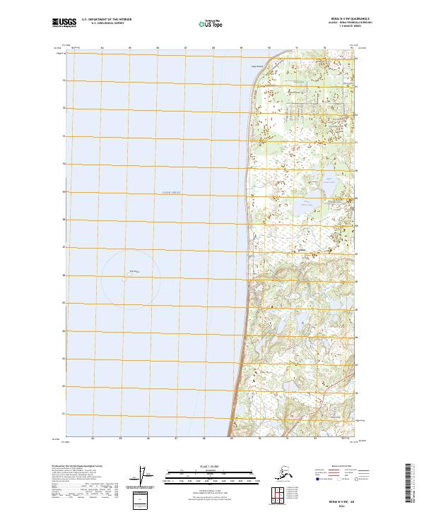
2024 Map of Kenai B-4 SW
USGS Topo · Published 2024About this map
Cape Kasilof stands as a prominent coastal landmark where the land meets the expansive Cook Inlet on the western edge of the Kenai Peninsula. This 2024 survey details the residential and recreational development of the Cohoe area, characterized by a grid of local roads and named avenues that weave between small bodies of water. The twin basins of Upper Cohoe Lake and Lower Cohoe Lake serve as central points for the surrounding neighborhood, connected by routes such as Cohoe Lake Drive and Fairway Avenue. Further south, the Sterling Highway provides the primary transit artery for the region, while the offshore terrain features a distinct formation known as The Sisters. The map reveals a transition from the structured residential corridors like Happys Trail Street to the vast wetlands and coastal flats that define this part of the borough.
Find a feature on this map
32 named features on this map. Tap any name to fly to it.
Don’t see what you’re looking for? This feature index may not catch every label — zoom into the map to look around manually.
Map Details
Editions of this 2024 Kenai B-4 SW Map
This is the sole edition of this map. No revisions or reprints were ever made.
Other maps of this area

1944 · Kenai
USGS Topo · 1:250,000

1950 · Kenai
USGS Topo · 1:250,000

1951 · Kenai A-5
USGS Topo · 1:63,360

1951 · Kenai B-4
USGS Topo · 1:63,360

1951 · Kenai A-4
USGS Topo · 1:63,360

1952 · Kenai A-5
USGS Topo · 1:63,360

1952 · Kenai B-4
USGS Topo · 1:63,360

1952 · Kenai A-4
USGS Topo · 1:63,360

1958 · Kenai
USGS Topo · 1:250,000
1986 · Kenai B-4 NW
USGS Topo · 1:25,000