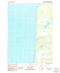
1986 Map of Kenai B-4 SW
USGS Topo · Published 1986About this map
Cape Kasilof and the mud-lined coast of Cook Inlet dominate this mid-1980s topographical study of the Kenai Peninsula. The landscape is defined by its transition from the tidal waters to a complex network of freshwater basins, including the distinct Upper Cohoe Lake and Lower Cohoe Lake. Further inland, the clustered Bottleneck Lakes break up the low-lying terrain, showing the watery character of this sub-arctic coastal environment. This map reflects a period of modern infrastructure development on the peninsula, evidenced by the presence of a Trans Line and a Gravel Pit near the southern boundary. The absence of dense residential labeling highlights the area's character as a resource-rich and largely unpopulated coastal stretch during this era of Alaskan growth.
Find a feature on this map
8 named features on this map. Tap any name to fly to it.
Don’t see what you’re looking for? This feature index may not catch every label — zoom into the map to look around manually.
Map Details
Editions of this 1986 Kenai B-4 SW Map
This is the sole edition of this map. No revisions or reprints were ever made.
Other maps of this area

1944 · Kenai
USGS Topo · 1:250,000

1950 · Kenai
USGS Topo · 1:250,000

1951 · Kenai A-5
USGS Topo · 1:63,360

1951 · Kenai B-4
USGS Topo · 1:63,360

1951 · Kenai A-4
USGS Topo · 1:63,360

1952 · Kenai A-5
USGS Topo · 1:63,360

1952 · Kenai B-4
USGS Topo · 1:63,360

1952 · Kenai A-4
USGS Topo · 1:63,360

1958 · Kenai
USGS Topo · 1:250,000
1986 · Kenai B-4 NW
USGS Topo · 1:25,000