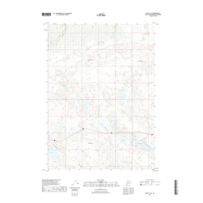
2017 Map of Kenai C-2 SE
USGS Topo · Published 2017About this map
Afonasi Lake and Watson Lake lie at the heart of this Kenai Peninsula landscape, where a dense network of glacial water bodies defines the terrain. The map illustrates a transitional wilderness area where local access is primarily facilitated by the Skilak Lake Road corridor. The placement of Equmen Lake and the nearby Seven Lakes suggests a complex hydrological system typical of this region's low-lying basins. Recreational and backcountry movement is evidenced by the Seven Lakes Trail, which connects several larger water features including Kelly Lake. The northern portion of the quadrangle is dominated by more isolated features like Trumpeter Lake and Broad Lake, while the E Fork Moose Cr provides a primary drainage route through the eastern sector.
Find a feature on this map
20 named features on this map. Tap any name to fly to it.
Don’t see what you’re looking for? This feature index may not catch every label — zoom into the map to look around manually.
Map Details
Editions of this 2017 Kenai C-2 SE Map
This is the sole edition of this map. No revisions or reprints were ever made.
Other maps of this area

1944 · Kenai
USGS Topo · 1:250,000

1950 · Kenai
USGS Topo · 1:250,000

1950 · Kenai B-1
USGS Topo · 1:63,360

1951 · Kenai B-2
USGS Topo · 1:63,360

1951 · Kenai C-1
USGS Topo · 1:63,360

1951 · Kenai C-2
USGS Topo · 1:63,360

1952 · Kenai C-1
USGS Topo · 1:63,360

1952 · Kenai C-2
USGS Topo · 1:63,360

1952 · Kenai B-2
USGS Topo · 1:63,360

1952 · Kenai B-1
USGS Topo · 1:63,360