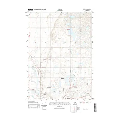
2014 Map of Kenai C-3 SW
USGS Topo · Published 2014About this map
Kenai and its neighboring communities on the Kenai Peninsula are captured here in 2014, showcasing a landscape where suburban growth meets the sprawling networks of the Alaskan wilderness. The map details the transition from the city centers of Soldotna and Kalifornsky to the dense lake districts of the interior. The importance of aviation to this region is evident through the placement of Bangerter Field Airport and Dahler Homestead Airport.
Find a feature on this map
69 named features on this map. Tap any name to fly to it.
Don’t see what you’re looking for? This feature index may not catch every label — zoom into the map to look around manually.
Map Details
Editions of this 2014 Kenai C-3 SW Map
This is the sole edition of this map. No revisions or reprints were ever made.
Other maps of this area

1944 · Kenai
USGS Topo · 1:250,000

1950 · Kenai
USGS Topo · 1:250,000

1950 · Kenai C-3
USGS Topo · 1:63,360

1950 · Kenai B-3
USGS Topo · 1:63,360

1951 · Kenai C-4
USGS Topo · 1:63,360

1951 · Kenai C-3
USGS Topo · 1:63,360

1951 · Kenai B-4
USGS Topo · 1:63,360

1952 · Kenai B-3
USGS Topo · 1:63,360

1952 · Kenai C-4
USGS Topo · 1:63,360
1952 · Kenai C-3
USGS Topo · 1:63,360