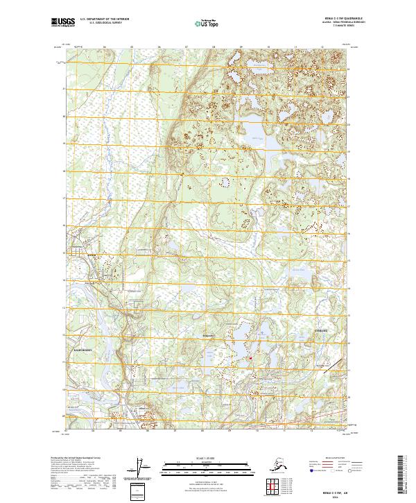
2024 Map of Kenai C-3 SW
USGS Topo · Published 2024About this map
The Kenai National Wildlife Refuge dominates the interior of this Kenai Peninsula landscape, where a complex network of glacial lakes and wetlands defines the terrain between Cook Inlet and the Chugach Mountains. Residential development and local aviation hubs cluster near the Kenai River, a vital corridor for both natural life and regional settlement. Small airstrips like Bangerter Field and the Dahler Homestead-Airport highlight the importance of light aircraft in this part of Alaska, serving communities that transitioned from early homesteads to modern townships.
Find a feature on this map
88 named features on this map. Tap any name to fly to it.
Don’t see what you’re looking for? This feature index may not catch every label — zoom into the map to look around manually.
Map Details
Editions of this 2024 Kenai C-3 SW Map
This is the sole edition of this map. No revisions or reprints were ever made.
Other maps of this area

1944 · Kenai
USGS Topo · 1:250,000

1950 · Kenai
USGS Topo · 1:250,000

1950 · Kenai C-3
USGS Topo · 1:63,360

1950 · Kenai B-3
USGS Topo · 1:63,360

1951 · Kenai C-4
USGS Topo · 1:63,360

1951 · Kenai C-3
USGS Topo · 1:63,360

1951 · Kenai B-4
USGS Topo · 1:63,360

1952 · Kenai B-3
USGS Topo · 1:63,360

1952 · Kenai C-4
USGS Topo · 1:63,360
1952 · Kenai C-3
USGS Topo · 1:63,360