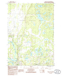
1986 Map of Kenai C-3 SW
USGS Topo · Published 1986About this map
The Kenai River winds through this mid-1980s survey, anchoring a landscape where the expanding settlements of Kenai and Soldotna meet the edge of the Kenai National Wildlife Refuge. The map illustrates the region's developing infrastructure, featuring a Trailer Park, several Gravel Pits, and a Substation alongside energy transit markers like the Trans Line Pipe Line. A dense network of water bodies, including Elephant Lake, Mackeys Lakes, and Sports Lake, defines the local geography. Significant for local historians and recreation researchers, the map identifies specific river landmarks such as Big Eddy Hole and Eagle Rock, as well as numerous Boat Ramps and campgrounds that mark the area's importance for river access and wilderness management during this era of Alaskan growth.
Find a feature on this map
31 named features on this map. Tap any name to fly to it.
Don’t see what you’re looking for? This feature index may not catch every label — zoom into the map to look around manually.
Map Details
Editions of this 1986 Kenai C-3 SW Map
This is the sole edition of this map. No revisions or reprints were ever made.
Other maps of this area

1944 · Kenai
USGS Topo · 1:250,000

1950 · Kenai
USGS Topo · 1:250,000

1950 · Kenai C-3
USGS Topo · 1:63,360

1950 · Kenai B-3
USGS Topo · 1:63,360

1951 · Kenai C-4
USGS Topo · 1:63,360

1951 · Kenai C-3
USGS Topo · 1:63,360

1951 · Kenai B-4
USGS Topo · 1:63,360

1952 · Kenai B-3
USGS Topo · 1:63,360

1952 · Kenai C-4
USGS Topo · 1:63,360
1952 · Kenai C-3
USGS Topo · 1:63,360