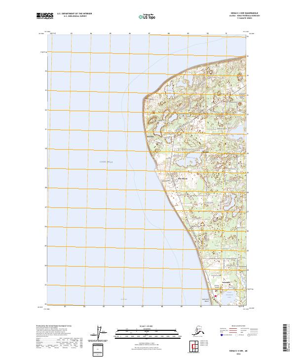
2024 Map of Kenai C-4 NW
USGS Topo · Published 2024About this map
Cook Inlet defines the western edge of this coastal landscape, where the settlements of Nikiski and Salamatof are established amidst a network of glacial lakes and industrial corridors. The area's aviation and maritime infrastructure is prominent, featuring the McGahan Industrial Airpark to the north and the Johnson Airport further south near Lower Salamatof Lake. The shoreline transitions from the prominent East Foreland down to Salamatof Beach, illustrating the interface between the inlet and the developed uplands.
Find a feature on this map
72 named features on this map. Tap any name to fly to it.
Don’t see what you’re looking for? This feature index may not catch every label — zoom into the map to look around manually.
Map Details
Editions of this 2024 Kenai C-4 NW Map
This is the sole edition of this map. No revisions or reprints were ever made.
Other maps of this area

1944 · Kenai
USGS Topo · 1:250,000

1950 · Kenai
USGS Topo · 1:250,000

1950 · Kenai D-4
USGS Topo · 1:63,360

1951 · Kenai C-4
USGS Topo · 1:63,360

1952 · Kenai D-4
USGS Topo · 1:63,360

1952 · Kenai C-4
USGS Topo · 1:63,360

1958 · Kenai C-5
USGS Topo · 1:63,360

1958 · Kenai D-5
USGS Topo · 1:63,360

1958 · Kenai
USGS Topo · 1:250,000
1986 · Kenai C-4 NW
USGS Topo · 1:25,000