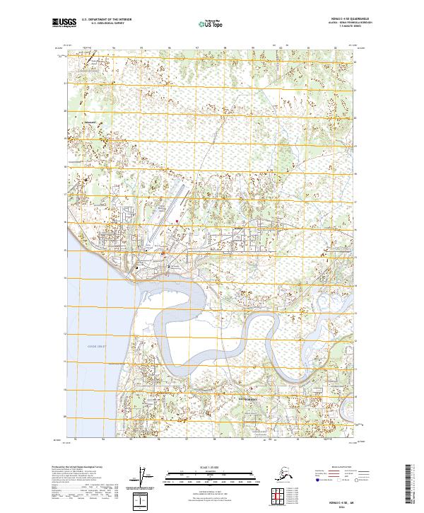
2024 Map of Kenai C-4 SE
USGS Topo · Published 2024About this map
The winding Kenai River snakes through this coastal landscape, meeting the waters of Cook Inlet at the established community of Kenai. This contemporary survey shows a region defined by its aviation infrastructure and administrative role, featuring Kenai Municipal Airport, the smaller Treasure Chest Airport, and the Kenai Courthouse. The cultural and historical landscape is centered on sites like the Holy Assumption of the Virgin Mary Cem and Kenai City Cem. Settlement patterns follow the Kenai Spur Highway, connecting the main town with Salamatof to the north and Kalifonsky to the south. The layout of residential streets, such as Walnut Avenue and Redout Avenue, illustrates the modern growth of the peninsula against the natural wetlands and the course of Beaver Creek.
Find a feature on this map
102 named features on this map. Tap any name to fly to it.
Don’t see what you’re looking for? This feature index may not catch every label — zoom into the map to look around manually.
Map Details
Editions of this 2024 Kenai C-4 SE Map
This is the sole edition of this map. No revisions or reprints were ever made.
Other maps of this area

1944 · Kenai
USGS Topo · 1:250,000

1950 · Kenai
USGS Topo · 1:250,000

1950 · Kenai C-3
USGS Topo · 1:63,360

1950 · Kenai B-3
USGS Topo · 1:63,360

1951 · Kenai C-4
USGS Topo · 1:63,360

1951 · Kenai C-3
USGS Topo · 1:63,360

1951 · Kenai B-4
USGS Topo · 1:63,360

1952 · Kenai B-3
USGS Topo · 1:63,360

1952 · Kenai C-4
USGS Topo · 1:63,360
1952 · Kenai C-3
USGS Topo · 1:63,360