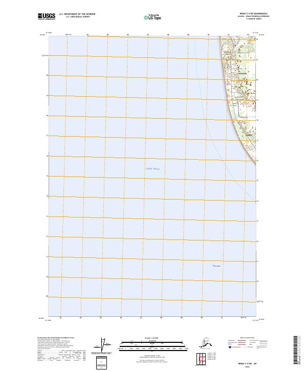
2024 Map of Kenai C-4 SW
USGS Topo · Published 2024About this map
Salamatof sits perched along the eastern edge of Cook Inlet, where the residential developments of the Kenai Peninsula meet the Alaskan shoreline. The map reveals a transition from the coastal waters of Salamatof Beach and the distinctive Salmo Rock to a structured grid of local roads and residential lanes. Notable thoroughfares like Treasure Chest Avenue and Kenai Spur Highway provide the primary connections through this northern reach of Kenai.
Find a feature on this map
17 named features on this map. Tap any name to fly to it.
Don’t see what you’re looking for? This feature index may not catch every label — zoom into the map to look around manually.
Map Details
Editions of this 2024 Kenai C-4 SW Map
This is the sole edition of this map. No revisions or reprints were ever made.
Other maps of this area

1944 · Kenai
USGS Topo · 1:250,000

1950 · Kenai
USGS Topo · 1:250,000

1951 · Kenai C-4
USGS Topo · 1:63,360

1951 · Kenai B-4
USGS Topo · 1:63,360

1952 · Kenai C-4
USGS Topo · 1:63,360

1952 · Kenai B-4
USGS Topo · 1:63,360

1958 · Kenai C-5
USGS Topo · 1:63,360

1958 · Kenai
USGS Topo · 1:250,000
1986 · Kenai B-4 NW
USGS Topo · 1:25,000
1986 · Kenai C-4 NW
USGS Topo · 1:25,000