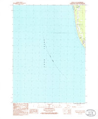
1986 Map of Kenai C-4 SW
USGS Topo · Published 1986About this map
Kenai sits perched along the eastern edge of this coastal survey, where the terrestrial landscape meets the expansive waters of Cook Inlet. The map documents a specific moment in the mid-1980s development of the Kenai Peninsula, showing a mix of residential clusters and aviation infrastructure like the Landing Strip. To the north, the small settlement of Salamatof and an adjacent Trailer Park indicate the expanding footprint of local communities.
Find a feature on this map
14 named features on this map. Tap any name to fly to it.
Don’t see what you’re looking for? This feature index may not catch every label — zoom into the map to look around manually.
Map Details
Editions of this 1986 Kenai C-4 SW Map
This is the sole edition of this map. No revisions or reprints were ever made.
Other maps of this area

1944 · Kenai
USGS Topo · 1:250,000

1950 · Kenai
USGS Topo · 1:250,000

1951 · Kenai C-4
USGS Topo · 1:63,360

1951 · Kenai B-4
USGS Topo · 1:63,360

1952 · Kenai C-4
USGS Topo · 1:63,360

1952 · Kenai B-4
USGS Topo · 1:63,360

1958 · Kenai C-5
USGS Topo · 1:63,360

1958 · Kenai
USGS Topo · 1:250,000
1986 · Kenai B-4 NW
USGS Topo · 1:25,000
1986 · Kenai C-4 NW
USGS Topo · 1:25,000