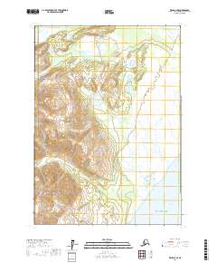
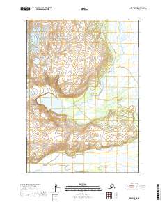
2017 Map of Kenai C-7 SE
USGS Topo · Published 2017About this map
Lake Clark National Park dominates the western portion of this coastal landscape, where the Chigmit Mountains meet the lowlands of the Cook Inlet. The terrain transitions from the high peaks of Mt Saint Florian down into an intricate network of wetlands and tidal flats. Waterways like Drift River and Cannery Cr wind through the northern sections, while Little Jack Slough drains the marshy eastern expanse toward the coast. The southern edge of the map opens onto Redoubt Bay and the broader waters of the Gulf of Alaska. This area is characterized by its dynamic glacial drainage and coastal influence, showing the complex hydrology of Katekin Cr as it flows through the southern reaches. The map highlights the sharp contrast between the protected wilderness of the national park and the expansive, watery flats along the shoreline.
Find a feature on this map
12 named features on this map. Tap any name to fly to it.
Don’t see what you’re looking for? This feature index may not catch every label — zoom into the map to look around manually.
Map Details
Editions of this 2017 Kenai C-7 SE Map
This is the sole edition of this map. No revisions or reprints were ever made.
Other maps of this area

1944 · Kenai
USGS Topo · 1:250,000

1950 · Kenai
USGS Topo · 1:250,000

1958 · Kenai B-7
USGS Topo · 1:63,360

1958 · Kenai C-6
USGS Topo · 1:63,360

1958 · Kenai C-7
USGS Topo · 1:63,360
1958 · Kenai B-6
USGS Topo · 1:63,360

1958 · Kenai
USGS Topo · 1:250,000
2017 · Kenai C-6 SW
USGS Topo · 1:25,000
2017 · Kenai C-7 SW
USGS Topo · 1:25,000
2017 · Kenai C-7 NE
USGS Topo · 1:25,000