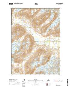
2017 Map of Kenai C-8 SW
USGS Topo · Published 2017About this map
Lake Clark National Park anchors this portion of the Kenai Peninsula, where the landscape is defined by the drainage basins of significant glacial rivers. The Drift River weaves through the northern and central sections of the quadrangle, creating a broad, braided channel as it cuts through the high relief of the surrounding terrain. To the south, the N Fork Crescent River flows through the township of t5n r21w, illustrating the complex hydrological network of the Cook Inlet region. This 2017 survey provides a high-resolution view of the topographical contours and undeveloped wilderness at the eastern edge of the park boundary, documenting the natural state of these river valleys before they reach the coast.
Find a feature on this map
7 named features on this map. Tap any name to fly to it.
Don’t see what you’re looking for? This feature index may not catch every label — zoom into the map to look around manually.
Map Details
Editions of this 2017 Kenai C-8 SW Map
This is the sole edition of this map. No revisions or reprints were ever made.
Other maps of this area

1944 · Kenai
USGS Topo · 1:250,000

1946 · Lake Clark
USGS Topo · 1:250,000

1950 · Kenai
USGS Topo · 1:250,000

1951 · Lake Clark
USGS Topo · 1:250,000

1958 · Lake Clark B-1
USGS Topo · 1:63,360

1958 · Kenai B-8
USGS Topo · 1:63,360

1958 · Kenai C-8
USGS Topo · 1:63,360
1958 · Lake Clark C-1
USGS Topo · 1:63,360

1958 · Lake Clark
USGS Topo · 1:250,000

1958 · Kenai
USGS Topo · 1:250,000