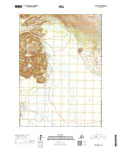
2017 Map of Kenai D-6 SW
USGS Topo · Published 2017About this map
Lake Clark National Park occupies the northwestern corner of this 2017 survey, where high-elevation contours mark the edge of the Chigmit Mountains. This landscape is defined by the complex hydrography of the Big River basin, showing a network of glacial meltwater channels and braided river systems. The North Fork Big River flows southward through the center of the sheet, eventually meeting the S Fork Big River in a wide valley of wetlands and shifting gravel bars. Tributaries like Bachatna Cr and Bachatna Creek descend from the eastern slopes, illustrating the transition from steep mountain terrain to the broad, hydrologically active lowlands. This map provides a detailed record of water drainage patterns and protected wilderness boundaries in the Kenai Peninsula Borough before recent changes in glacial recession and alluvial deposition.
Find a feature on this map
10 named features on this map. Tap any name to fly to it.
Don’t see what you’re looking for? This feature index may not catch every label — zoom into the map to look around manually.
Map Details
Editions of this 2017 Kenai D-6 SW Map
This is the sole edition of this map. No revisions or reprints were ever made.
Other maps of this area

1944 · Kenai
USGS Topo · 1:250,000

1950 · Kenai
USGS Topo · 1:250,000

1958 · Kenai C-6
USGS Topo · 1:63,360

1958 · Kenai D-6
USGS Topo · 1:63,360

1958 · Kenai D-7
USGS Topo · 1:63,360

1958 · Kenai C-7
USGS Topo · 1:63,360

1958 · Kenai
USGS Topo · 1:250,000
2017 · Kenai C-7 NE
USGS Topo · 1:25,000
2017 · Kenai C-6 NW
USGS Topo · 1:25,000
2017 · Kenai D-6 NW
USGS Topo · 1:25,000