
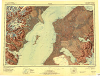
1950 Map of Kenai
USGS Topo · Published 1950About this map
The Kenai Peninsula shoreline is a study in mid-century Alaskan settlement and wild lands, where the new Sterling Highway begins to carve a path through the Kenai National Moose Range. This reconnaissance-era sheet documents a transitional period for the eastern coast of Cook Inlet, showing established coastal outposts like Ninilchik and Kasilof alongside the emerging town of Soldotna. Across the inlet, the landscape shifts dramatically toward the icy summits of the Alaska Range, dominated by the towering Redoubt Volcano and the remote Tuxedni National Wildlife Refuge. Commercial activity is grounded in the coastal environment, evidenced by the Snug Harbor Cannery near Chisik Island. From the Salamatof village site to the vast Harding Ice Field, the map captures the interplay between the territory's deep indigenous and Russian-colonial history and the post-war infrastructure development that would eventually transform the region.
Find a feature on this map
128 named features on this map. Tap any name to fly to it.
Don’t see what you’re looking for? This feature index may not catch every label — zoom into the map to look around manually.
Map Details
Editions of this 1950 Kenai Map
2 editions found
Other maps of this area

1944 · Kenai
USGS Topo · 1:250,000

1946 · Blying Sound
USGS Topo · 1:250,000

1946 · Lake Clark
USGS Topo · 1:250,000

1946 · Seldovia D-5
USGS Topo · 1:63,360

1949 · Tyonek
USGS Topo · 1:250,000

1949 · Seldovia D-4
USGS Topo · 1:63,360

1950 · Kenai C-3
USGS Topo · 1:63,360

1950 · Kenai B-1
USGS Topo · 1:63,360

1950 · Seldovia D-2
USGS Topo · 1:63,360

1950 · Seward A-8
USGS Topo · 1:63,360