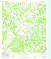
1964 Map of Kendalia
USGS Topo · Published 1982About this map
The Guadalupe River carves a deep, winding path through the heart of this Kendall County landscape, which was updated in 1982 to reflect shifts in land use through purple-ink revisions. At the center of the community stands Kendalia, a small settlement positioned near the headwaters of Curry Creek. The terrain is defined by a dense network of drainages and named breaks like Coyote Canyon and Thornton Canyon, which feed into the river valley.
Find a feature on this map
28 named features on this map. Tap any name to fly to it.
Don’t see what you’re looking for? This feature index may not catch every label — zoom into the map to look around manually.
Map Details
Editions of this 1964 Kendalia Map
2 editions found
Other maps of this area

1887 · Blanco
USGS Topo · 1:125,000

1894 · Fredericksburg
USGS Topo · 1:125,000

1894 · Blanco
USGS Topo · 1:125,000

1920 · Smithsons Valley
USGS Topo · 1:62,500

1927 · Smithson Valley
USGS Topo · 1:62,500

1929 · Smithson Valley
USGS Topo · 1:62,500

1940 · Smithson Valley
USGS Topo · 1:62,500

1954 · Llano
USGS Topo · 1:250,000

1954 · San Antonio
USGS Topo · 1:250,000

1955 · Llano
USGS Topo · 1:250,000