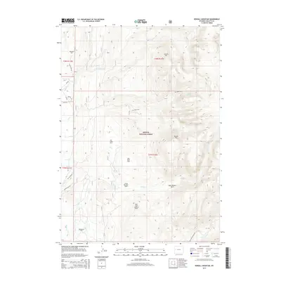
2015 Map of Kendall Mountain
USGS Topo · Published 2015About this map
Kendall Mtn rises above the high mountain landscape of Sublette County, marking the transition between the dense timber of Bridger National Forest and the expansive glacial basins to the south. This 2015 study details the hydrologic network feeding the New Fork River, including the complex drainage systems of Pot Creek, Jim Creek, and Boulder Creek. The map provides a precise record of late-20th and early-21st-century land management, showcasing the network of forest access roads such as Gypsum Creek Rd and the Boulder Basin Rd that connect isolated landmarks like New Fork Lookout Point. Topographic features such as McDowell Flat and Kim Rush Park offer specific locations for researchers studying the grazing and recreational history of the western Wind River Range foothills.
Find a feature on this map
32 named features on this map. Tap any name to fly to it.
Don’t see what you’re looking for? This feature index may not catch every label — zoom into the map to look around manually.
Map Details
Editions of this 2015 Kendall Mountain Map
This is the sole edition of this map. No revisions or reprints were ever made.
Other maps of this area

1907 · Gros Ventre
USGS Topo · 1:125,000

1909 · Fremont Peak
USGS Topo · 1:125,000

1910 · Gros Ventre
USGS Topo · 1:125,000

1955 · Driggs
USGS Topo · 1:250,000

1955 · Thermopolis
USGS Topo · 1:250,000

1958 · Driggs
USGS Topo · 1:250,000

1958 · Thermopolis
USGS Topo · 1:250,000

1962 · Thermopolis
USGS Topo · 1:250,000

1962 · Driggs
USGS Topo · 1:250,000
1966 · Warren Bridge
USGS Topo · 1:24,000