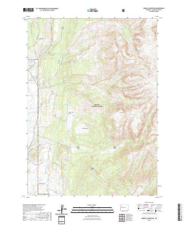
2021 Map of Kendall Mountain
USGS Topo · Published 2021About this map
Bridger National Forest defines the high-altitude landscape of this Wyoming quadrangle, where the headwaters of the New Fork River begin their descent. The terrain is marked by significant peaks such as Kendall Mtn and Saltlick Mtn, which overlook a series of glacial basins and parks. Distinctive meadows like Pot Creek Park and Kim Rush Park provide level breaks in the topography between steep ridges.
Find a feature on this map
34 named features on this map. Tap any name to fly to it.
Don’t see what you’re looking for? This feature index may not catch every label — zoom into the map to look around manually.
Map Details
Editions of this 2021 Kendall Mountain Map
This is the sole edition of this map. No revisions or reprints were ever made.
Other maps of this area

1907 · Gros Ventre
USGS Topo · 1:125,000

1909 · Fremont Peak
USGS Topo · 1:125,000

1910 · Gros Ventre
USGS Topo · 1:125,000

1955 · Driggs
USGS Topo · 1:250,000

1955 · Thermopolis
USGS Topo · 1:250,000

1958 · Driggs
USGS Topo · 1:250,000

1958 · Thermopolis
USGS Topo · 1:250,000

1962 · Thermopolis
USGS Topo · 1:250,000

1962 · Driggs
USGS Topo · 1:250,000
1966 · Warren Bridge
USGS Topo · 1:24,000