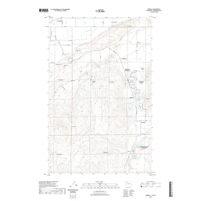
2020 Map of Kendall
USGS Topo · Published 2020About this map
Kendall and the surrounding valley communities of Peaceful Valley and Columbia Valley occupy the eastern flats of this Whatcom County landscape, where the North Fork Nooksack River meets the drainages of Kendall Cr and Racehorse Cr. The terrain is dominated by the massive rise of Sumas Mtn and Vedder Mtn, creating a sharp divide between the low-lying agricultural and residential areas and the steep, wooded uplands. Natural history and conservation interests are represented by the Nooksack Salmon Hatchery located near the riverbank, while local history researchers can identify several burial grounds including Saint Peters Cem, Sumas Cem, and Kendall Cem. The map reveals a transition from the structured residential roads of Balford to the winding tracks of Paradise Valley and the heights of Sugarloaf Hill, reflecting the area's mixed character of rural settlement and managed wilderness in the early twenty-first century.
Find a feature on this map
77 named features on this map. Tap any name to fly to it.
Don’t see what you’re looking for? This feature index may not catch every label — zoom into the map to look around manually.
Map Details
Editions of this 2020 Kendall Map
This is the sole edition of this map. No revisions or reprints were ever made.
Other maps of this area

1906 · Sumas
USGS Topo · 1:62,500

1908 · Sumas
USGS Topo · 1:62,500

1919 · Van Zandt
USGS Topo · 1:62,500

1951 · Van Zandt
USGS Topo · 1:62,500

1952 · Lawrence
USGS Topo · 1:24,000

1952 · Sumas
USGS Topo · 1:24,000

1954 · Lynden
USGS Topo · 1:62,500

1957 · Victoria
USGS Topo · 1:250,000

1972 · Maple Falls
USGS Topo · 1:24,000
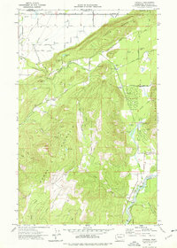
1972 · Kendall
USGS Topo · 1:24,000