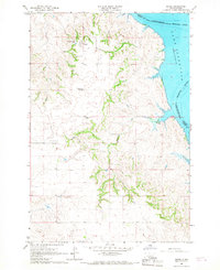
1966 Map of Kenel
USGS Topo · Published 1967About this map
Kenel sits overlooking the vast expanse of the Oahe Reservoir along the Missouri River in this mid-1960s survey. The landscape is defined by the sharp transition between the dissected plateaus of the Standing Rock Indian Reservation and the inundated river valley. The map reveals a community structured around its spiritual and educational hubs, notably St Benedict Ch and Kenel Sch.
Find a feature on this map
14 named features on this map. Tap any name to fly to it.
Don’t see what you’re looking for? This feature index may not catch every label — zoom into the map to look around manually.
Map Details
Editions of this 1966 Kenel Map
2 editions found
Other maps of this area

1953 · McIntosh
USGS Topo · 1:250,000

1956 · Wakpala
USGS Topo · 1:24,000

1958 · McIntosh
USGS Topo · 1:250,000

1965 · Pollock SE
USGS Topo · 1:24,000

1965 · Pollock
USGS Topo · 1:24,000

1966 · Mahto NE
USGS Topo · 1:24,000

1966 · Kenel
USGS Topo · 1:24,000

1966 · Kline Buttes
USGS Topo · 1:24,000

1966 · Pollock NW
USGS Topo · 1:24,000

1967 · Mobridge NE
USGS Topo · 1:24,000