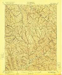
1907 Map of Kenna
USGS Topo · Published 1921About this map
Staats Mills and Sissonville anchor this early 20th-century landscape, where Jackson, Roane, and Kanawha counties meet. Surveyed in 1906, the topography reveals a dense network of ridges and hollows defined by the Pocatalico River and its numerous tributaries like Frog Creek and Wolfpen Hollow. The settlement pattern is strikingly linear, with homes and community centers following the narrow valley floors and creek beds.
Find a feature on this map
56 named features on this map. Tap any name to fly to it.
Don’t see what you’re looking for? This feature index may not catch every label — zoom into the map to look around manually.
Map Details
Editions of this 1907 Kenna Map
3 editions found
Other maps of this area

1897 · Kanawha Falls
USGS Topo · 1:125,000

1899 · Charleston
USGS Topo · 1:125,000

1900 · Kanawha Falls
USGS Topo · 1:125,000

1901 · Kanawha Falls
USGS Topo · 1:125,000

1906 · Kenna
USGS Topo · 1:62,500

1906 · Winfield
USGS Topo · 1:62,500

1906 · Walton
USGS Topo · 1:62,500

1907 · Kenna
USGS Topo · 1:62,500

1907 · Spencer
USGS Topo · 1:62,500

1907 · Walton
USGS Topo · 1:62,500