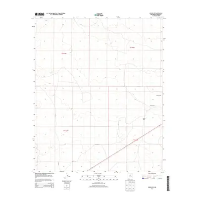
2013 Map of Kenna SW
USGS Topo · Published 2013About this map
Kenna Draw and Falsey Draw define the drainage patterns of this high plains landscape in eastern Chaves County. The terrain is sparsely settled, characterized primarily by its dry watercourses and livestock infrastructure such as Kelly Tank. This 2013 survey highlights the gridded organization of the public land survey system, specifically covering parts of t5s r28e, t5s r29e, and t6s r29e. Transportation through this arid region relies on a few critical corridors, including Co Road 77 and Mesquite Rd. This map reflects the vast, open character of the New Mexico interior, where water sources and survey lines dictate the footprint of human activity and ranching operations.
Find a feature on this map
9 named features on this map. Tap any name to fly to it.
Don’t see what you’re looking for? This feature index may not catch every label — zoom into the map to look around manually.
Map Details
Editions of this 2013 Kenna SW Map
This is the sole edition of this map. No revisions or reprints were ever made.
Other maps of this area

1954 · Brownfield
USGS Topo · 1:250,000

1955 · Roswell
USGS Topo · 1:250,000

1958 · Brownfield
USGS Topo · 1:250,000

1958 · Roswell
USGS Topo · 1:250,000

1962 · Roswell
USGS Topo · 1:250,000

1962 · Brownfield
USGS Topo · 1:250,000

1967 · Elkins
USGS Topo · 1:24,000
1967 · Denton Camp
USGS Topo · 1:24,000
1967 · Olive
USGS Topo · 1:24,000

1978 · Curlew Lake
USGS Topo · 1:24,000