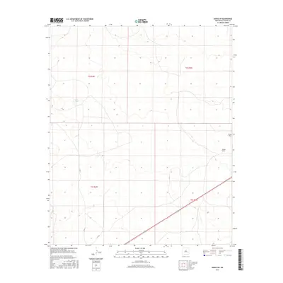
2017 Map of Kenna SW
USGS Topo · Published 2017About this map
Kenna Draw and Falsey Draw define the topography of this high plains region in eastern New Mexico, where the landscape is marked by subtle drainage patterns and seasonal water catchments. The presence of Kelly Tank in the northwestern sector suggests the importance of water management for local ranching operations in this arid environment. This 2017 U.S. Geological Survey representation details the modern transportation infrastructure, including the diagonal path of Highway 70 and the network of local routes like Co RD 77 and Co RD 46. The quadrangle is neatly divided by township and range boundaries, such as t6s r29e and t6s r30e, illustrating the persistent influence of the Public Land Survey System on the spatial organization of Chaves County.
Find a feature on this map
10 named features on this map. Tap any name to fly to it.
Don’t see what you’re looking for? This feature index may not catch every label — zoom into the map to look around manually.
Map Details
Editions of this 2017 Kenna SW Map
This is the sole edition of this map. No revisions or reprints were ever made.
Other maps of this area

1954 · Brownfield
USGS Topo · 1:250,000

1955 · Roswell
USGS Topo · 1:250,000

1958 · Brownfield
USGS Topo · 1:250,000

1958 · Roswell
USGS Topo · 1:250,000

1962 · Roswell
USGS Topo · 1:250,000

1962 · Brownfield
USGS Topo · 1:250,000

1967 · Elkins
USGS Topo · 1:24,000
1967 · Denton Camp
USGS Topo · 1:24,000
1967 · Olive
USGS Topo · 1:24,000

1978 · Curlew Lake
USGS Topo · 1:24,000