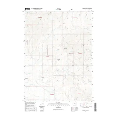
2015 Map of Kennaday Peak
USGS Topo · Published 2015About this map
Kennaday Peak anchors this high-elevation landscape within the Medicine Bow National Forest, where the terrain is defined by a dense network of mountain drainages and ridges. The map documents human intersection with this environment through ranching landmarks like the Oberg Ranch and infrastructure such as the Cedar Creek Ranch Airport. Water management is evident in the presence of the Wiant Supply Ditch and Highland Ditch, which divert natural flows across the varying topography of Buffalo Gulch and Elk Hollow Creek.
Find a feature on this map
51 named features on this map. Tap any name to fly to it.
Don’t see what you’re looking for? This feature index may not catch every label — zoom into the map to look around manually.
Map Details
Editions of this 2015 Kennaday Peak Map
This is the sole edition of this map. No revisions or reprints were ever made.
Other maps of this area

1893 · Fort Steele
USGS Topo · 1:125,000

1906 · Medicine Bow
USGS Topo · 1:125,000

1908 · Medicine Bow
USGS Topo · 1:125,000

1939 · Saratoga
USGS Topo · 1:125,000

1954 · Rawlins
USGS Topo · 1:250,000

1955 · Elk Mountain SW
USGS Topo · 1:24,000

1955 · Oberg Ranch
USGS Topo · 1:24,000

1955 · Coad Mountain
USGS Topo · 1:24,000

1958 · Rawlins
USGS Topo · 1:250,000

1961 · Ryan Park
USGS Topo · 1:24,000