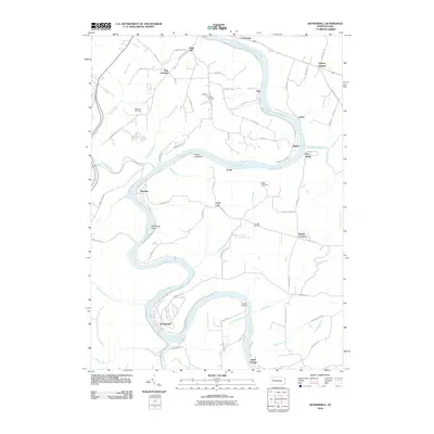
2010 Map of Kennerdell
USGS Topo · Published 2010About this map
The Allegheny River carves a deep, serpentine path through this 2010 landscape, anchoring a series of small settlements and riverfront landmarks. Near the village of Kennerdell, the river winds around Whitherup Island and past the landmark Indian God Rock, a site of significant petroglyphs and cultural history. The map documents several upland communities such as Coal City, Smiths Corners, and Victory Heights, many connected by rural routes like Coal City Rd and Victory Church Rd. Genealogists will find a high concentration of burial sites throughout the terrain, including Morrison Cemetery, Graham Cemetery, Melat Cemetery, and the Shaffer Cemetery south of Falling Spring Run. The presence of the Rails to Trails Dr alongside the river indicates the transition of old industrial rail corridors into modern recreational use.
Find a feature on this map
83 named features on this map. Tap any name to fly to it.
Don’t see what you’re looking for? This feature index may not catch every label — zoom into the map to look around manually.
Map Details
Editions of this 2010 Kennerdell Map
This is the sole edition of this map. No revisions or reprints were ever made.
Other maps of this area

1907 · Foxburg
USGS Topo · 1:62,500

1908 · Foxburg
USGS Topo · 1:62,500

1909 · Franklin
USGS Topo · 1:62,500

1910 · Hilliards
USGS Topo · 1:62,500

1911 · Franklin
USGS Topo · 1:62,500

1912 · Hilliards
USGS Topo · 1:62,500

1922 · Oil City
USGS Topo · 1:48,000

1924 · Oil City
USGS Topo · 1:62,500

1943 · Oil City
USGS Topo · 1:62,500

1944 · Hilliards
USGS Topo · 1:62,500