2023 Map of Kennerdell
USGS Topo · Published 2023About this map
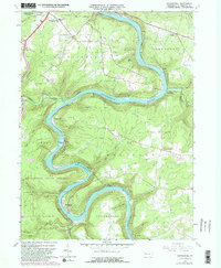
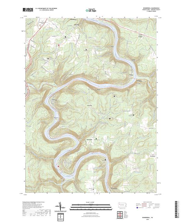
The Allegheny River carves a deep, winding course through Venango County, defining the settlement patterns of this river-and-rail corridor. Along the eastern banks and plateau, small communities like Coal City, Ajax, and Kennerdell are connected by a network of rural roads and historical routes. The landscape is dotted with small family burial grounds, such as the Morrison Family Cem and the Graham Cem, which provide essential touchpoints for genealogical research in this part of Pennsylvania.
Find a feature on this map
117 named features on this map. Tap any name to fly to it.
Don’t see what you’re looking for? This feature index may not catch every label — zoom into the map to look around manually.
Map Details
Editions of this 2023 Kennerdell Map
This is the sole edition of this map. No revisions or reprints were ever made.