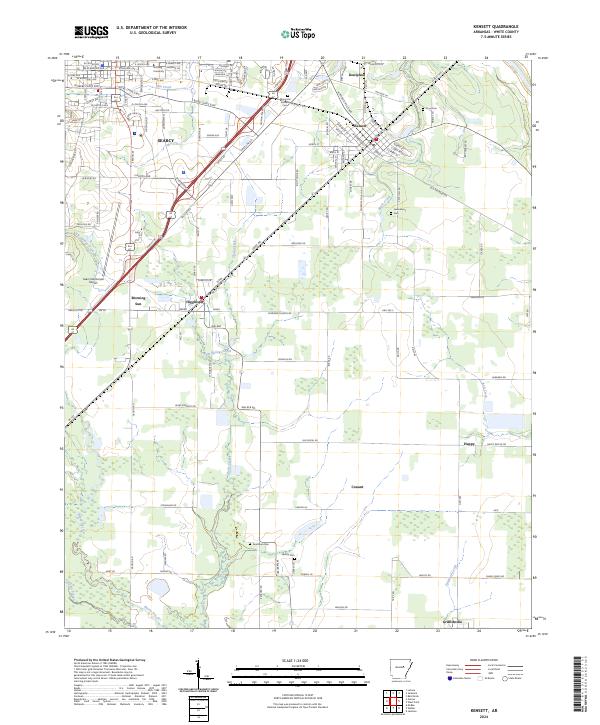
2024 Map of Kensett
USGS Topo · Published 2024About this map
Harding University and the eastern reaches of Searcy define the northwestern corner of this landscape, where the urban grid gives way to the agricultural flatlands of White County. The terrain is characterized by a complex network of waterways, including Gin Creek, Glade Creek, and Gum Springs Creek, which eventually drain toward Bayou Des Arc in the south. These creek systems historically dictated the placement of early settlements like Doniphan, Kensett, and Higginson, which are interconnected by a web of regional roads such as W Beebe Capps Expy and Sunny Dale Rd.
Find a feature on this map
144 named features on this map. Tap any name to fly to it.
Don’t see what you’re looking for? This feature index may not catch every label — zoom into the map to look around manually.
Map Details
Editions of this 2024 Kensett Map
This is the sole edition of this map. No revisions or reprints were ever made.
Other maps of this area

1932 · Kensett
USGS Topo · 1:62,500

1935 · Kensett
USGS Topo · 1:62,500

1935 · Bald Knob
USGS Topo · 1:62,500

1953 · Memphis
USGS Topo · 1:250,000

1956 · Memphis
USGS Topo · 1:250,000

1962 · Letona
USGS Topo · 1:24,000

1963 · Garner
USGS Topo · 1:24,000
1963 · Mc Rae
USGS Topo · 1:24,000
1964 · Walker
USGS Topo · 1:24,000
1964 · Kensett
USGS Topo · 1:24,000