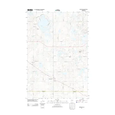
2013 Map of Kensington
USGS Topo · Published 2013About this map
Kensington sits at the intersection of Co HWY-1 and MN-55, serving as a central hub for this portion of Douglas County. The landscape is characterized by a dense cluster of water bodies including Red Rock Lake, Lake Oscar, and Eng Lake, which dictate the local road patterns and land use. The topography reveals significant local landmarks such as Runestone Hill and Lookout Mountain, features that suggest the glacial history of the region.
Find a feature on this map
55 named features on this map. Tap any name to fly to it.
Don’t see what you’re looking for? This feature index may not catch every label — zoom into the map to look around manually.
Map Details
Editions of this 2013 Kensington Map
This is the sole edition of this map. No revisions or reprints were ever made.
Other maps of this area

1911 · Barrett
USGS Topo · 1:62,500

1912 · Morris
USGS Topo · 1:62,500

1953 · Saint Cloud
USGS Topo · 1:250,000

1957 · Saint Cloud
USGS Topo · 1:250,000

1958 · Saint Cloud
USGS Topo · 1:250,000

1966 · Brandon
USGS Topo · 1:24,000

1966 · Farwell
USGS Topo · 1:24,000

1966 · Kensington
USGS Topo · 1:24,000

1966 · Quam Lake
USGS Topo · 1:24,000

1968 · Lowry
USGS Topo · 1:24,000