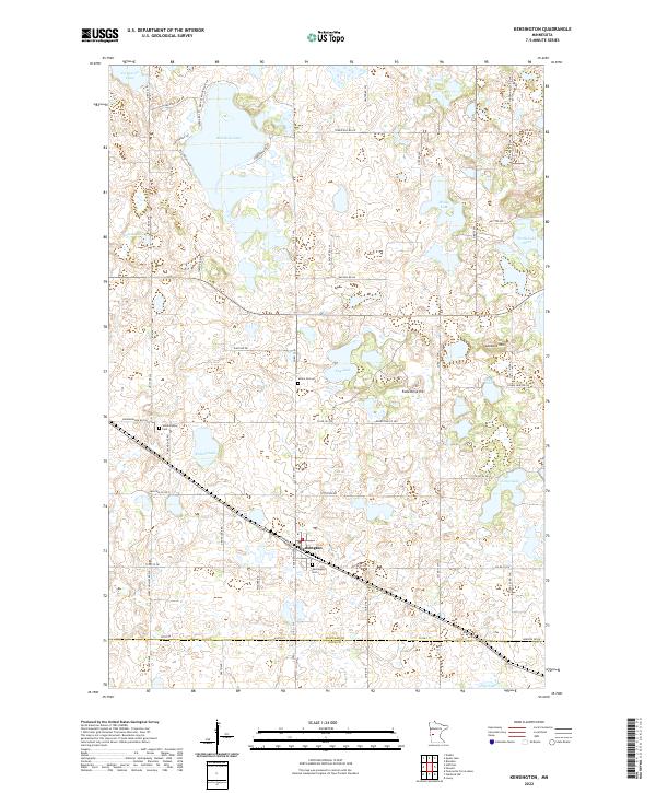
2022 Map of Kensington
USGS Topo · Published 2022About this map
Kensington anchors this west-central Minnesota landscape, situated at the intersection of a rail line and local thoroughfares. The terrain is defined by a dense concentration of glacial basins, ranging from the large Red Rock Lake in the north to smaller bodies such as Solemn Lake and Roland Lake. This distribution of water influenced the placement of early infrastructure, seen in the winding paths of Tower Hill Rd SW and the proximity of Runestone Hill, a landmark tied to the region's cultural identity.
Find a feature on this map
105 named features on this map. Tap any name to fly to it.
Don’t see what you’re looking for? This feature index may not catch every label — zoom into the map to look around manually.
Map Details
Editions of this 2022 Kensington Map
This is the sole edition of this map. No revisions or reprints were ever made.
Other maps of this area

1911 · Barrett
USGS Topo · 1:62,500

1912 · Morris
USGS Topo · 1:62,500

1953 · Saint Cloud
USGS Topo · 1:250,000

1957 · Saint Cloud
USGS Topo · 1:250,000

1958 · Saint Cloud
USGS Topo · 1:250,000

1966 · Brandon
USGS Topo · 1:24,000

1966 · Farwell
USGS Topo · 1:24,000

1966 · Kensington
USGS Topo · 1:24,000

1966 · Quam Lake
USGS Topo · 1:24,000

1968 · Lowry
USGS Topo · 1:24,000