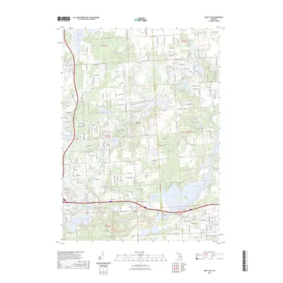
2023 Map of Kent Lake
USGS Topo · Published 2023About this map
Kent Lake and the Huron River define this corner of the state where the Livingston Co and Oakland Co lines meet. The landscape is characterized by its heavy concentration of water bodies, from the sprawling Island Lake Rec Area in the south to smaller basins like Sears Lake, Honeywell Lake, and Lake of the Pines. Genealogists will find a cluster of burial sites that trace the region's early settlement history, including the Old Kensington Cem and Kensington Baptist Church Cem, alongside the Woodruff Farm Cem, Bird Cem, and Pleasant Valley Cem.
Find a feature on this map
57 named features on this map. Tap any name to fly to it.
Don’t see what you’re looking for? This feature index may not catch every label — zoom into the map to look around manually.
Map Details
Editions of this 2023 Kent Lake Map
This is the sole edition of this map. No revisions or reprints were ever made.
Other maps of this area

1902 · South Lyon
USGS Topo · 1:62,500

1902 · Dexter
USGS Topo · 1:62,500

1904 · Ann Arbor
USGS Topo · 1:125,000

1906 · Dexter
USGS Topo · 1:62,500

1906 · South Lyon
USGS Topo · 1:62,500

1907 · Howell
USGS Topo · 1:62,500

1908 · Ann Arbor
USGS Topo · 1:125,000

1909 · Howell
USGS Topo · 1:62,500

1909 · Milford
USGS Topo · 1:62,500

1936 · Wixom
USGS Topo · 1:31,680
Featured Places
- Lyon Charter Township, MI
- Green Oak Charter Township, MI
- Highland Charter Township, MI
- Brighton Charter Township, MI
- Milford Charter Township, MI