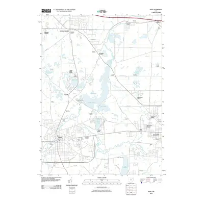
2010 Map of Kent
USGS Topo · Published 2010About this map
Kent State University anchors the southern landscape of this Portage County survey, where the Cuyahoga River winds through a network of reservoirs and suburban developments. The region is defined by its significant water bodies, including the massive Lake Rockwell and the smaller Brady Lake, which are bordered by established neighborhoods like Sugar Bush Knolls and Twin Lakes. Extensive drainage infrastructure such as Yoder Ditch and Brimfield Ditch illustrates the management of the local watershed between the larger hubs of Streetsboro, Kent, and the western edge of Ravenna. Genealogists and local historians can locate several historic burial grounds, from the Standing Rock Cemetery near the river to the Evergreen Cemetery and Riverside Cemetery further north. The map also captures specialized land uses like the Oak Knolls Golf Course, Beckwith Orchards, and the Portage County Airport, providing a detailed look at the county's mid-20th-century transition into a prominent academic and residential corridor.
Find a feature on this map
89 named features on this map. Tap any name to fly to it.
Don’t see what you’re looking for? This feature index may not catch every label — zoom into the map to look around manually.
Map Details
Editions of this 2010 Kent Map
This is the sole edition of this map. No revisions or reprints were ever made.
Other maps of this area

1905 · Garrettsville
USGS Topo · 1:62,500

1906 · Kent
USGS Topo · 1:62,500

1906 · Chagrin Falls
USGS Topo · 1:62,500

1906 · Ravenna
USGS Topo · 1:62,500

1907 · Garrettsville
USGS Topo · 1:62,500

1908 · Chagrin Falls
USGS Topo · 1:62,500

1908 · Ravenna
USGS Topo · 1:62,500

1950 · Cleveland
USGS Topo · 1:250,000

1953 · Aurora
USGS Topo · 1:24,000

1953 · Twinsburg
USGS Topo · 1:24,000