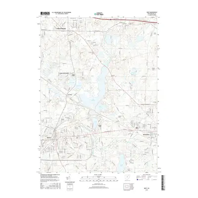
2016 Map of Kent
USGS Topo · Published 2016About this map
Kent and Ravenna anchor this 2016 survey, a landscape defined by the winding course of the Cuyahoga River and a significant network of glacial lakes and reservoirs. Central to the map is the expansive Lake Rockwell, which dominates the midsection alongside Lake Pippen and Brady Lake. This water system serves as a primary geographic feature between the urban centers, surrounded by smaller communities like Twin Lakes and Sugar Bush Knolls.
Find a feature on this map
60 named features on this map. Tap any name to fly to it.
Don’t see what you’re looking for? This feature index may not catch every label — zoom into the map to look around manually.
Map Details
Editions of this 2016 Kent Map
This is the sole edition of this map. No revisions or reprints were ever made.
Other maps of this area

1905 · Garrettsville
USGS Topo · 1:62,500

1906 · Kent
USGS Topo · 1:62,500

1906 · Chagrin Falls
USGS Topo · 1:62,500

1906 · Ravenna
USGS Topo · 1:62,500

1907 · Garrettsville
USGS Topo · 1:62,500

1908 · Chagrin Falls
USGS Topo · 1:62,500

1908 · Ravenna
USGS Topo · 1:62,500

1950 · Cleveland
USGS Topo · 1:250,000

1953 · Aurora
USGS Topo · 1:24,000

1953 · Twinsburg
USGS Topo · 1:24,000