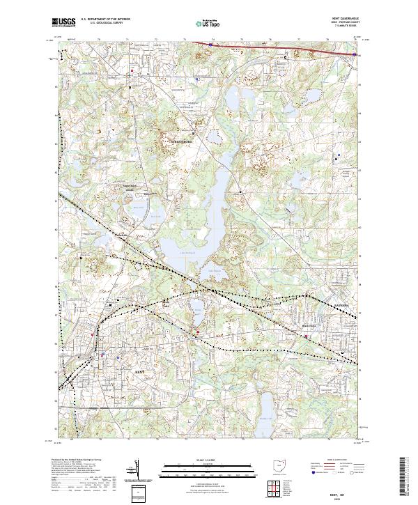
2023 Map of Kent
USGS Topo · Published 2023About this map
The Cuyahoga River corridor defines this portion of Portage County, winding through a landscape shaped by glacial kettle lakes and modern water management. The expansive Lake Rockwell dominates the center of the sheet, flanked by the smaller Lake Pippen and Brady Lake, illustrating the region's historical reliance on these natural and dammed reservoirs. To the south, the city of Kent is anchored by the sprawling campus of Kent State University, while the northern portion shows the suburban growth of Streetsboro.
Find a feature on this map
118 named features on this map. Tap any name to fly to it.
Don’t see what you’re looking for? This feature index may not catch every label — zoom into the map to look around manually.
Map Details
Editions of this 2023 Kent Map
This is the sole edition of this map. No revisions or reprints were ever made.
Historical Maps of Ravenna Township Through Time
4 maps found