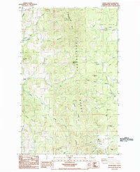
1985 Map of Kentry Ridge
USGS Topo · Published 1985About this map
The Huckleberry Range dominates this mid-1980s landscape, where the ridges and canyons of Stevens County reveal a history of resource extraction and isolated settlement. High-altitude mining activity is evident at the Aquila Mine and Daisy Mine, while several unnamed mines and gravel pits are scattered across the terrain. Small outposts like Arzina and Holden Hill sit among a complex drainage system that includes Cheweka Creek, Stranger Creek, and the distinctive bend known as The Horseshoe.
Find a feature on this map
44 named features on this map. Tap any name to fly to it.
Don’t see what you’re looking for? This feature index may not catch every label — zoom into the map to look around manually.
Map Details
Editions of this 1985 Kentry Ridge Map
2 editions found
Other maps of this area

1927 · Chewelah
USGS Topo · 1:125,000

1929 · Colville
USGS Topo · 1:125,000

1930 · Chewelah
USGS Topo · 1:125,000

1933 · Colville
USGS Topo · 1:125,000

1936 · Marcus
USGS Topo · 1:96,000

1942 · Marcus
USGS Topo · 1:125,000

1948 · Kettle Falls
USGS Topo · 1:62,500

1950 · Inchelium
USGS Topo · 1:62,500

1951 · Kettle Falls
USGS Topo · 1:62,500

1952 · Colville
USGS Topo · 1:24,000