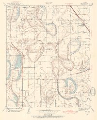
1939 Map of Keo
USGS Topo · Published 1954About this map
Plum Bayou snakes across this alluvial landscape, defining the character of the borderlands between Pulaski and Lonoke counties in the late 1930s. The region is marked by an intricate network of oxbows and abandoned channels like Ash Flat Lake, Clear Lake, and McNeils Bayou, reflecting the shifting nature of the Arkansas River to the west. A high concentration of rural institutions suggests a densely settled farming community, with numerous landmarks such as Estes Ch, Springfield Ch, and Cherry Hill Ch distributed along the higher ground of the ridges.
Find a feature on this map
33 named features on this map. Tap any name to fly to it.
Don’t see what you’re looking for? This feature index may not catch every label — zoom into the map to look around manually.
Map Details
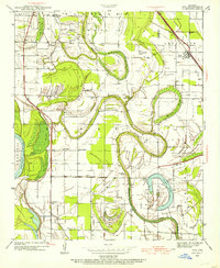
Editions of this 1939 Keo Map
3 editions found
Other maps of this area

1891 · Little Rock
USGS Topo · 1:125,000

1893 · Little Rock
USGS Topo · 1:125,000

1932 · Pastoria
USGS Topo · 1:62,500

1935 · Sweet Home
USGS Topo · 1:24,000

1935 · Altheimer
USGS Topo · 1:62,500

1935 · Pastoria
USGS Topo · 1:62,500

1937 · England
USGS Topo · 1:48,000

1939 · Keo
USGS Topo · 1:31,680

1940 · Woodson
USGS Topo · 1:31,680

1941 · Keo
USGS Topo · 1:31,680