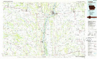
1986 Map of Keokuk
USGS Topo · Published 1986About this map
The tri-state confluence of Iowa, Illinois, and Missouri defines this mid-1980s landscape, where the Mississippi River and Des Moines River converge. At the center of this river system sits Keokuk, a major hub marked by the massive Keokuk Dam and Lock and Dam No 19. Across the water, the Illinois town of Warsaw and the riverfront in Hamilton illustrate the interconnected commerce of the region. The map captures a detailed transport network including the Atchison, Topeka and Santa Fe Railway and the Burlington Northern Railroad, which served the industrial and agricultural needs of the Mississippi valley.
Find a feature on this map
163 named features on this map. Tap any name to fly to it.
Don’t see what you’re looking for? This feature index may not catch every label — zoom into the map to look around manually.
Map Details
Editions of this 1986 Keokuk Map
2 editions found
Other maps of this area

1903 · Kahoka
USGS Topo · 1:125,000

1903 · Palmyra
USGS Topo · 1:125,000

1903 · Edina
USGS Topo · 1:125,000

1913 · Colchester
USGS Topo · 1:62,500

1918 · La Harpe
USGS Topo · 1:62,500

1925 · Quincy
USGS Topo · 1:62,500

1925 · Liberty
USGS Topo · 1:62,500

1926 · Mt Sterling
USGS Topo · 1:62,500

1927 · Liberty
USGS Topo · 1:62,500

1929 · Mt Sterling
USGS Topo · 1:62,500