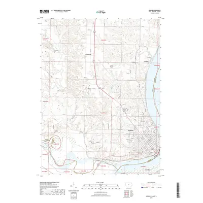
2018 Map of Keokuk
USGS Topo · Published 2018About this map
The confluence of the Mississippi River and the Des Moines River defines this tri-state border region, where Iowa, Missouri, and Illinois meet. Keokuk serves as the primary urban center, situated on the high bluffs overlooking the river valley and the low-lying Mud Island. The map reveals a high concentration of small family and community burial grounds throughout the surrounding hills, including the Oller Family Cem, Little Mound Cem, and the uniquely named The Yellow Banks Cem. North of the city, the landscape transitions from the grid-aligned streets of the river town to the rural uplands of Summitville and Sandusky. This 2018 survey detail provides a modern inventory of the region's geography, from the Keokuk Municipal Airport to the western bottomlands along Sugar Creek, capturing the enduring road network and land divisions that have shaped Lee County since the nineteenth century.
Find a feature on this map
151 named features on this map. Tap any name to fly to it.
Don’t see what you’re looking for? This feature index may not catch every label — zoom into the map to look around manually.
Map Details
Editions of this 2018 Keokuk Map
This is the sole edition of this map. No revisions or reprints were ever made.
Other maps of this area

1903 · Kahoka
USGS Topo · 1:125,000

1936 · Keokuk
USGS Topo · 1:62,500

1936 · Fort Madison
USGS Topo · 1:62,500

1949 · Wayland
USGS Topo · 1:24,000

1949 · Kahoka SE
USGS Topo · 1:24,000

1950 · Kahoka SE
USGS Topo · 1:24,000

1950 · Wayland
USGS Topo · 1:24,000

1950 · Keokuk
USGS Topo · 1:62,500

1958 · Burlington
USGS Topo · 1:250,000

1961 · Burlington
USGS Topo · 1:250,000