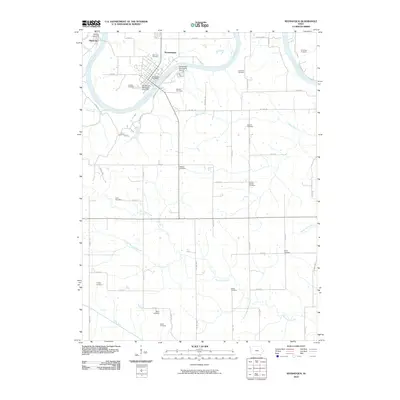
2010 Map of Keosauqua
USGS Topo · Published 2010About this map
The Des Moines River carves a dramatic oxbow through this portion of Van Buren County, anchoring the historic settlement of Keosauqua. This bend in the river historically dictated the layout of the town and its infrastructure, including the Keosauqua Post Office and the Keosauqua Municipal Airport situated just east of the main residential area. To the northwest, the smaller hamlet of Pittsburg sits near the mouth of Town Branch.
Find a feature on this map
59 named features on this map. Tap any name to fly to it.
Don’t see what you’re looking for? This feature index may not catch every label — zoom into the map to look around manually.
Map Details
Editions of this 2010 Keosauqua Map
This is the sole edition of this map. No revisions or reprints were ever made.
Other maps of this area

1954 · Centerville
USGS Topo · 1:250,000

1957 · Centerville
USGS Topo · 1:250,000

1958 · Centerville
USGS Topo · 1:250,000

1958 · Burlington
USGS Topo · 1:250,000

1961 · Burlington
USGS Topo · 1:250,000

1963 · Burlington
USGS Topo · 1:250,000

1965 · Douds
USGS Topo · 1:24,000

1968 · Anson
USGS Topo · 1:24,000

1968 · Bonaparte
USGS Topo · 1:24,000

1968 · Keosauqua
USGS Topo · 1:24,000