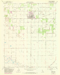
1963 Map of Kerman
USGS Topo · Published 1981About this map
The town of Kerman serves as a central hub for the agricultural and industrial activities of this Central Valley landscape during the early 1960s. The settlement pattern is defined by a rigid grid of arterial roads, including Kearney Boulevard and Whites Bridge Road, which facilitate the transport of goods across the Fresno County plains. The Southern Pacific railroad cuts through the heart of the community, underscoring its role in the regional rail economy.
Find a feature on this map
25 named features on this map. Tap any name to fly to it.
Don’t see what you’re looking for? This feature index may not catch every label — zoom into the map to look around manually.
Map Details
Editions of this 1963 Kerman Map
2 editions found
Other maps of this area

1923 · Kearney Park
USGS Topo · 1:31,680

1923 · Herndon
USGS Topo · 1:31,680

1923 · Biola
USGS Topo · 1:31,680

1924 · Jamesan
USGS Topo · 1:31,680

1924 · Gravelly Ford
USGS Topo · 1:31,680

1925 · Helm
USGS Topo · 1:31,680

1925 · San Joaquin
USGS Topo · 1:31,680

1925 · Raisin
USGS Topo · 1:31,680
1946 · Madera
USGS Topo · 1:62,500
1946 · Kearney Park
USGS Topo · 1:24,000