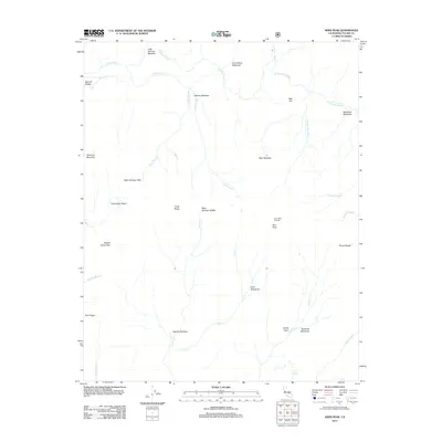
2012 Map of Kern Peak
USGS Topo · Published 2012About this map
Kern Peak stands as the dominant sentinel in this portion of Tulare County, crowned by the Kern Peak Lookout which provides a commanding view over the Toowa Range. The landscape is defined by a high-elevation network of drainage systems including the S Fork Kern River and Golden Trout Cr, interspersed with numerous meadows such as Little Whitney Meadow and Volcano Meadow. Geologic interests are evident at the Natural Bridge near Malpais Cr and the prominent Red Hill. The area's naming conventions, featuring labels like Hell for Sure Cr and Hells Hole Cr, suggest the demanding nature of the terrain for early travelers and surveyors. This map captures a pristine wilderness character, with narrow passes like Right Stringer Pass and Saddle Camp Pass marking the primary routes through the high ridges.
Find a feature on this map
38 named features on this map. Tap any name to fly to it.
Don’t see what you’re looking for? This feature index may not catch every label — zoom into the map to look around manually.
Map Details
Editions of this 2012 Kern Peak Map
This is the sole edition of this map. No revisions or reprints were ever made.
Other maps of this area

1905 · Olancha
USGS Topo · 1:125,000

1907 · Olancha
USGS Topo · 1:125,000

1948 · Fresno
USGS Topo · 1:250,000

1955 · Fresno
USGS Topo · 1:250,000

1956 · Fresno
USGS Topo · 1:250,000

1956 · Hockett Peak
USGS Topo · 1:62,500
1956 · Monache Mtn
USGS Topo · 1:62,500

1956 · Olancha
USGS Topo · 1:62,500
1956 · Kern Peak
USGS Topo · 1:62,500

1958 · Fresno
USGS Topo · 1:250,000