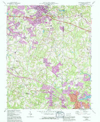
1969 Map of Kernersville
USGS Topo · Published 1994About this map
Kernersville serves as the focal point of this Piedmont survey, where the Southern railroad corridor established a historic industrial and transit spine through the landscape. The geography is defined by a dense network of small communities and rural intersections, including Beeson Crossroads, Union Cross, and the unusually named Horneytown. Purple revision overlays from the early 1990s reveal the rapid suburban expansion outward from the northern edge of High Point, particularly around the newly developed residential clusters near Oak Hollow Lake.
Find a feature on this map
49 named features on this map. Tap any name to fly to it.
Don’t see what you’re looking for? This feature index may not catch every label — zoom into the map to look around manually.
Map Details
Editions of this 1969 Kernersville Map
3 editions found
Other maps of this area

1949 · Eller
USGS Topo · 1:24,000

1949 · High Point West
USGS Topo · 1:24,000

1950 · High Point East
USGS Topo · 1:24,000

1950 · Winston-Salem East
USGS Topo · 1:24,000

1951 · Winston-Salem East
USGS Topo · 1:24,000

1951 · High Point East
USGS Topo · 1:24,000

1951 · Guilford
USGS Topo · 1:24,000

1951 · Walkertown
USGS Topo · 1:24,000

1953 · Raleigh
USGS Topo · 1:250,000

1953 · Charlotte
USGS Topo · 1:250,000