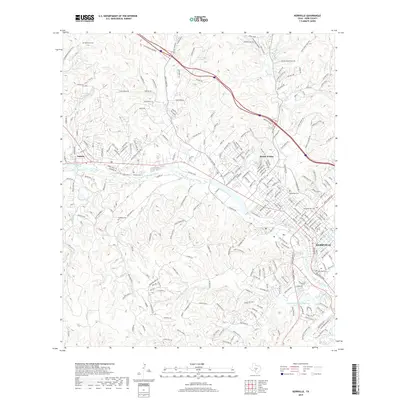
2019 Map of Kerrville
USGS Topo · Published 2019About this map
The Guadalupe River carves a central path through this Hill Country landscape, anchoring the connected communities of Kerrville, Ingram, and Mount Wesley. The 2019 survey reflects a mixture of established residential development and rugged ranch lands, where drainage features like Bear Cr and Nichols Cr define the local topography. Genealogists will find several burial sites preserved across the terrain, including Henderson Cem near the northwestern boundary and Mountain View Cem closer to the city center.
Find a feature on this map
248 named features on this map. Tap any name to fly to it.
Don’t see what you’re looking for? This feature index may not catch every label — zoom into the map to look around manually.
Map Details
Editions of this 2019 Kerrville Map
This is the sole edition of this map. No revisions or reprints were ever made.
Other maps of this area

1894 · Kerrville
USGS Topo · 1:125,000

1954 · Llano
USGS Topo · 1:250,000

1954 · San Antonio
USGS Topo · 1:250,000

1955 · Llano
USGS Topo · 1:250,000

1956 · Tuff
USGS Topo · 1:62,500

1956 · Center Point
USGS Topo · 1:62,500

1956 · Llano
USGS Topo · 1:250,000

1957 · San Antonio
USGS Topo · 1:250,000

1964 · Morris Ranch
USGS Topo · 1:24,000

1964 · Nott Branch
USGS Topo · 1:24,000