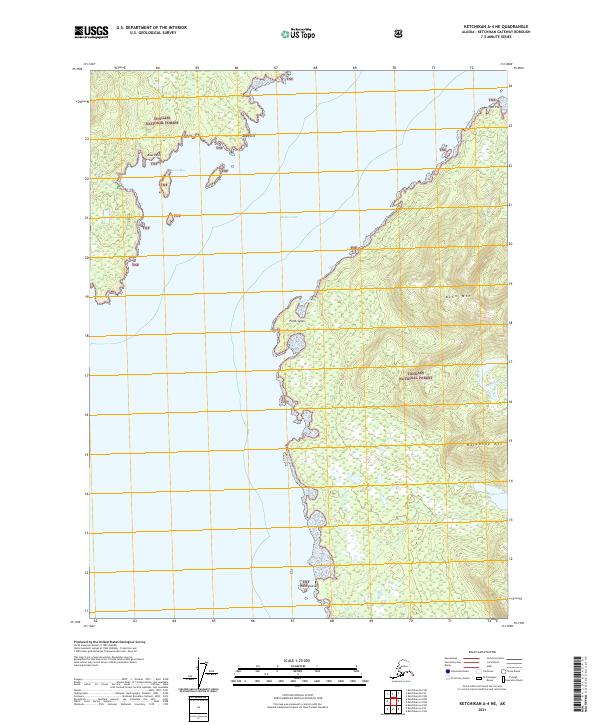
2021 Map of Ketchikan A-4 NE
USGS Topo · Published 2021About this map
Tongass National Forest dominates this coastal Alaskan landscape, where the waters of the Behm Canal separate rugged mountainous terrain from the intricate shoreline of Revillagigedo Island. The geography is defined by sharp elevation changes, rising from the canal to the heights of Behm Mtn and Backbone Mtn. This survey captures a wild stretch of the Ketchikan Gateway Borough characterized by deep inlets and prominent coastal landmarks such as Point Sykes, Roe Point, and Alava Point. Small freshwater features like Sykes Lake and Sykes Creek drain the timbered interior, while Alava Bay provides a sheltered cove behind Bass Point. The presence of Black Island in the southern reach of the canal illustrates the complex archipelago nature of this region, providing essential context for those studying the maritime and natural history of the Alexander Archipelago.
Find a feature on this map
19 named features on this map. Tap any name to fly to it.
Don’t see what you’re looking for? This feature index may not catch every label — zoom into the map to look around manually.
Map Details
Editions of this 2021 Ketchikan A-4 NE Map
This is the sole edition of this map. No revisions or reprints were ever made.
Other maps of this area

1949 · Ketchikan B-4
USGS Topo · 1:63,360

1952 · Ketchikan
USGS Topo · 1:250,000

1952 · Ketchikan B-4
USGS Topo · 1:63,360

1955 · Ketchikan A-4
USGS Topo · 1:63,360

1955 · Ketchikan A-3
USGS Topo · 1:63,360

1955 · Ketchikan B-3
USGS Topo · 1:63,360

1955 · Ketchikan
USGS Topo · 1:250,000
1995 · Ketchikan B-4
USGS Topo · 1:63,360
2017 · Ketchikan A-4 SE
USGS Topo · 1:25,000
2017 · Ketchikan B-4 SE
USGS Topo · 1:25,000